Iron County Lodging Association

Scenic Drives in Iron County, Michigan: Spring and Summer Routes

Iron County • Michigan • Upper Peninsula

Two-lane roads run past clear lakes, high spring rivers and old iron towns, and you'll have most of them to yourself. Here are the routes, distances and stops worth the drive, from snowmelt to the end of summer.

16 MILES
The Heritage Trail byway on US-2, Iron River to Crystal Falls
14 STOPS
History stops on the Iron County Heritage Trail
ABOUT 1 HOUR
From Iron River to Bond Falls, just over the county line
20 MILES
The lake loop past Lake Ottawa and Hagerman Lake
Start Here

The Best Scenic Drives in Iron County, Michigan

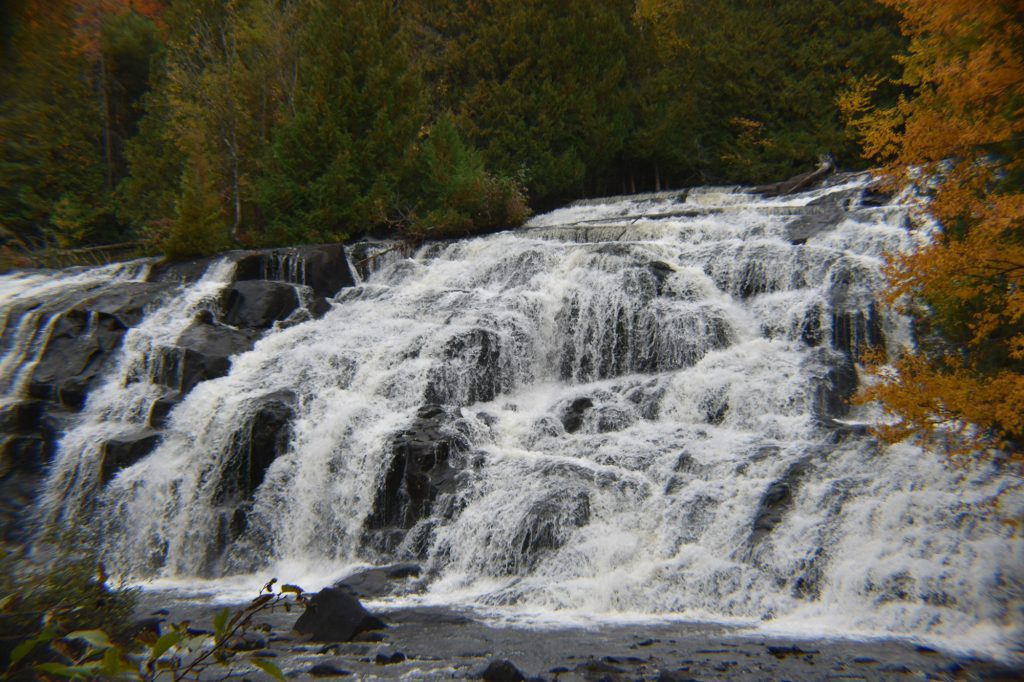
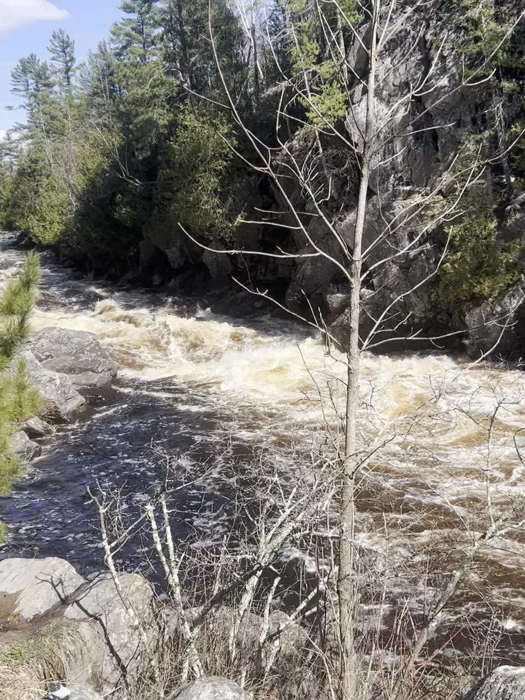
The Paint River running high and white through Horserace Rapids in April

It comes down to how much time you have. With an hour, drive the Iron County Heritage Trail, 16 miles of US-2 between Iron River and Crystal Falls and a Pure Michigan Byway since 2000.

With half a day, come back the long way on County Road 424 through Caspian, Gaastra and Alpha. It makes a loop of about 36 miles. With a full day, take the waterfall loop out to Bond and Agate Falls.

Spring is for high water. In April and May the rivers run full and the falls are at their loudest. Summer is for the lakes, long evenings and a slow drive home at dusk.

Coming in October? Our Fall Color Drives guide has the fall routes.

Stay In Iron County

Where to Stay for a Scenic Drive in Iron County

The Routes

Iron County Scenic Drive Routes: Heritage Trail, Backroads and Lakes

Eight drives, from a twenty-minute run down the byway to a slow day on the back roads. Hover or tap a card for directions and stops.

About 16 miles · the byway

The Heritage Trail on US-2

The official byway, Iron River to Crystal Falls.

More

The four-lane between Iron River and Crystal Falls is the state's Iron County Heritage Trail. Four miles before Crystal Falls, Bewabic State Park sits on Fortune Lake, and you'll need a Recreation Passport to drive in. Use the Heritage Trail stop list to plan where to pull in.
About 36 miles · half day

The Heritage Loop on County Road 424

Old mining towns, a lake park and Alpha's circle.

More

Take M-189 south to Caspian, where the Iron County Historical Museum opens its exhibits in summer. Then follow CR-424 east through Gaastra and past Pentoga Park on the south end of Chicaugon Lake, with its Chippewa burial grounds. Go around Alpha's 1914 traffic circle, stop at Alpha Michigan Brewing Co., and come back from Crystal Falls on US-2.

About 20 miles round trip

Lake Ottawa and Hagerman Lake

A national forest loop just southwest of Iron River.

More

Take US-2 to M-73, then Lake Ottawa Road about four miles to the Lake Ottawa Recreation Area. There's a day-use fee in season. Come around on Hagerman Lake Road and back out to M-73. If you've got more time, West Brule Lake Road leads on toward Mile Post Zero, the 1840 survey marker on the state line.

South · the Brule

M-73 and M-189 to the Wisconsin Line

Two short highways down to the Brule River.

More

Both run south from US-2 to the Brule River, which is the Wisconsin line. M-73 leaves US-2 west of Iron River and runs about eight miles through the woods past the Hagerman and Bass lakes. M-189 runs about eight miles south from Iron River past Caspian. Go down one and come back up the other.

Backroad · 2 miles to the river

Pentoga Trail and Pentoga Road

A county favorite along Chicaugon Lake to the Brule.

More

Pentoga Trail, County Road 639, runs to CR-424 along Chicaugon Lake. From there Pentoga Road drops about two miles down to the Brule River. It's one of four Iron County roads on Michigan's statewide list of favorite county backroads.

About 11 miles · two rivers

Bates-Amasa Road

North along the Paint and the Hemlock.

More

County Road 643 runs north from US-2 to US-141 beside the Paint and Hemlock rivers. Come back down US-141 from Amasa, about 13 miles to Crystal Falls, and you've made a loop.

North · the big woods

Forest Highway 16 and Gibbs City Road

Paved highway or gravel backroad into the national forest.

More

Forest Highway 16 leaves US-2 about 13½ miles west of Iron River and runs north through the Ottawa National Forest toward Kenton. Golden Lake is just up the road, and the turn for Duppy Falls is on it too (see our waterfalls guide). For a slower drive, take Gibbs City and Ponozzo Roads about 13 miles north out of Iron River.

East · mining history

M-69 Out of Crystal Falls

An old arched bridge, a lake and a mine-disaster church.

More

Start at the Harbour House Museum, open Saturday afternoons, then follow Superior Avenue down from the courthouse, over the old arched bridge on the Paint River and east past Runkle Lake. Up Mansfield Cutoff Road stands Pioneer Church, a memorial to the 27 miners who died in the Mansfield mine in 1893.

A Full Day

Bond Falls and Agate Falls: A Waterfall Drive from Iron County

Just outside Iron County

Both falls are over the line in Ontonagon County, but they make the best full-day drive out of Iron River. Go after the snow is gone and the water is still high.

Bond Falls US-2 west about 30 miles to Watersmeet, US-45 north, then Bond Falls Road 3 miles. About an hour from Iron River. Cars can usually get in from mid-May to mid-October. Recreation Passport required.
Agate Falls On M-28, about 7 miles east of Bruce Crossing. A short, paved but steep trail leads to a platform under the railroad trestle. The lot is kept up May through October.
The Loop FH-16 north to Kenton, M-28 west to Agate, US-45 south to Bond, then home on US-2. About 113 miles, a little over 3 hours of driving. Fill up first.
Watch The Treetops Iron County calls itself the Bald Eagle Capital of the Midwest, and West US-2 toward Watersmeet is the stretch to watch. Let your passenger do the looking.
April & May

Spring Scenic Drives in the Upper Peninsula: Snowmelt Rivers and Trillium

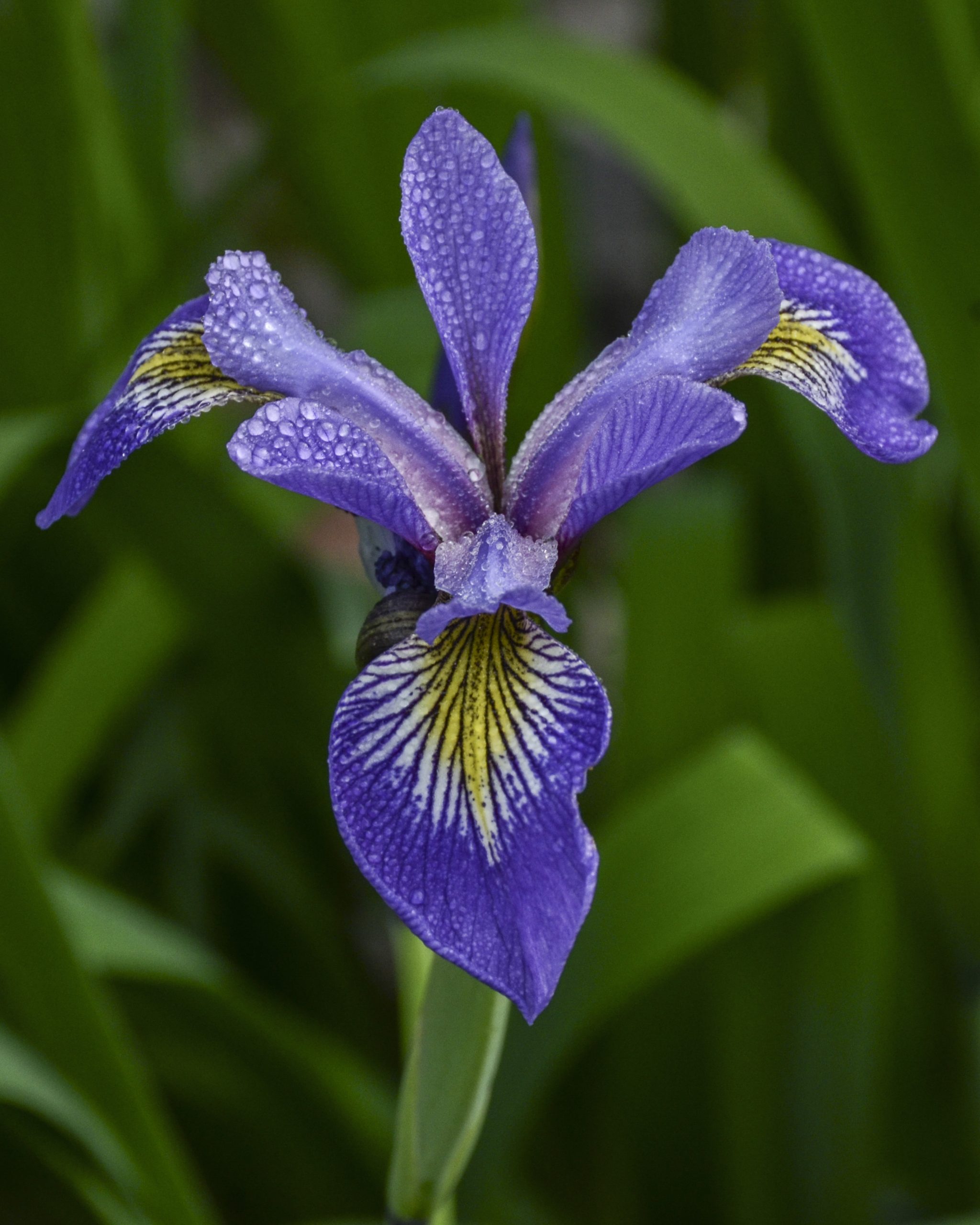
A blue flag iris blooming in the spring woods of Iron County

When the snow lets go, the rivers come up. In April and May the Paint, the Brule and the Iron run high and fast, and Horserace Rapids south of Crystal Falls is at its loudest. Directions are in our waterfalls guide.

Watch the forest floor for trillium in spring, especially around Pentoga Park off CR-424. The birds come back too, and loons and eagles show up on the Fortune Lakes by Bewabic.

Trout season opens the last Saturday in April, so pack a rod. Our trout fishing guide has the streams. For more to do, see our spring guide and the spring weekend getaway.

Before you leave the pavement: spring is when the gravel and forest roads are softest. Stick to pavement after a hard rain.
June To August

Summer Scenic Drives in Iron County: Lakes, Long Evenings and Wildlife at Dusk

A pontoon boat crossing a wooded Iron County lake on a summer day

Summer drives end at the water. Drive out to Lake Ottawa, to Chicaugon Lake at Pentoga Park, or to Fortune Lake at Bewabic. Pentoga opens the Friday before Memorial Day (see our Memorial Day guide), and our Best Lakes guide goes lake by lake.

The history stops are open in summer too. The Iron County Historical Museum in Caspian opens its exhibits from June through September, and the Harbour House Museum in Crystal Falls opens on Saturdays.

Get coffee at Contrast Coffee or Seven Embers in Iron River. Have lunch at Logans' Place in Crystal Falls or a beer at Alpha Michigan Brewing Co. Check hours before you go.

Drive home slow. Deer cross at dawn and dusk, and the county roads are where you'll meet them.

Road Sense

Before You Drive: Gravel Roads, Gas and Spring Road Conditions

  • Spring forest roads. Snowmelt can leave washouts, soft or muddy stretches and downed trees. Check the national forest road conditions before you go, and turn around rather than push through.
  • Pavement runs out. The state highways and FH-16 are paved. Many county and forest roads turn to gravel or dirt.
  • Fill the tank. You can get gas in Iron River, Crystal Falls, Caspian and Amasa. Fill up before FH-16 or the waterfall loop.
  • Download the map. Phone service gets thin in the national forest, so save your route before you leave town.
  • Share the road. Many county roads are open to ORVs, so expect to meet a few. Our ATV and ORV guide has the riding.
  • Never shoot from the wheel. Pull fully off the road where it's legal and safe, then take the picture.

Iron County runs on Central time, an hour behind most of Michigan.

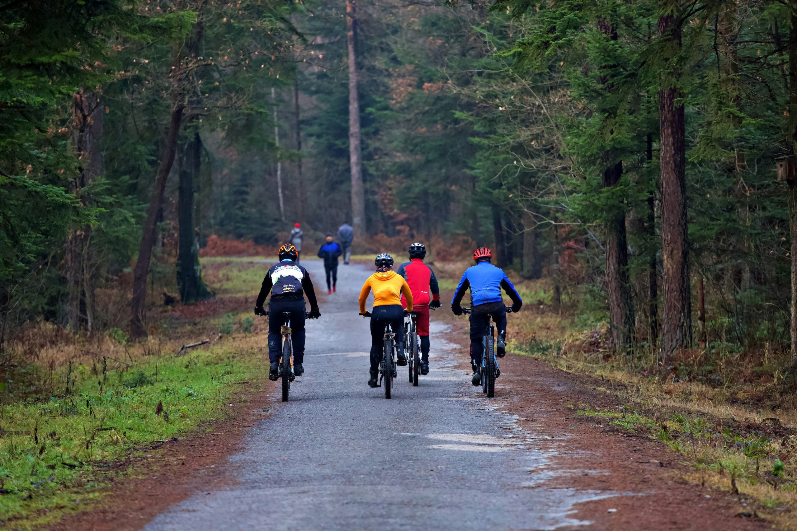
Four cyclists riding a paved path through tall pines in spring
A child and parent floating on an inflatable shark at Pentoga Park in summer
A family walking a grassy trail through green spring woods
In The Fall

Fall Color Drives

The same roads in October, with the backroads the locals pick for color.

Fall Color Drives
Falling Water

Waterfalls in Iron County

Horserace Rapids, Duppy Falls and the rest, with how to find each one.

Waterfalls Guide
On The Water

Best Lakes

Beaches, paddling and fishing, lake by lake across the county.

Best Lakes Guide
Out Of The Car

Hiking and Biking

Park the car and walk or ride, from a short stroll to a full day in the national forest.

Hiking & Biking Guide
Questions

Scenic Drives in Iron County, Michigan: Common Questions

What is the most scenic drive in Iron County, Michigan?

The Iron County Heritage Trail on US-2, 16 miles between Iron River and Crystal Falls. For a slower drive, come back on County Road 424 through Caspian, Gaastra and Alpha.

Is the Iron County Heritage Trail a Pure Michigan Byway?

Yes. It has been a historic Pure Michigan Byway on US-2 since 2000, with 14 stops across the county.

How far is Bond Falls from Iron River, Michigan?

About 43 miles, or about an hour. Take US-2 west to Watersmeet, then US-45 north. Bond Falls is just outside Iron County, in Ontonagon County.

Are the back roads in Iron County, Michigan paved?

Some are and some aren't. The state highways and Forest Highway 16 are paved, but many county and forest roads are gravel, and they're softest in spring.

When is the best time for a spring scenic drive in the Upper Peninsula?

April and May, for high rivers and loud waterfalls. Wait until the snow is gone and the forest roads have dried out before you leave the pavement.

Where can you see bald eagles in Iron County, Michigan?

Along the highways, especially West US-2 toward Watersmeet. Eagles and loons also show up on the Fortune Lakes by Bewabic State Park.

Start Planning

Plan a Scenic Drive in Iron County

Come in May when the rivers are loud, or in July when the lakes are warm and the evenings run long. Then find a room close to the road you want to drive first.

Spring, Summer, Travel Planning and tagged , , , , , , , .

Rewarding Places to Stay in Michigan

Blue-Time-2-1-landscape-1bda4d794f0b78ad7a9dc76edd7e42f1-s2dm8kz6age4
AmericInn
by Wyndham

906-214-2308
906-265-9100
40 E Adams St
Iron River, MI 49935

motel-2026-picture-1
Chicaugon
Lake Inn

906-265-9244
1700 County Road 424
Gaastra, MI 49917

1000024941
Lakeshore Motel
Ice Lake

906-265-3611
1257 W Ice Lake Rd
Iron River, MI 49935

Pg-19_Inset_fireworks-landscape-76b9c76c809f50200abf168229bdde8c-nwgu45p89z7j
Pioneer
Lodge

800-362-7853
373 Brule Mountain Rd
Iron River, MI 49935

lodge
Ski Brule
Village

800-DO-BRULE
906-265-4957
397 Brule Mountain Rd
Iron River, MI 49935

tallpines
Tall
Pines

906-822-7713
1968 US 141 Highway
Amasa, MI 49903

Iron County Michigan Visitors Guide

Iron County is one of the Upper Peninsula’s best kept secrets. From camping to fishing, hunting to canoeing, mountain biking to forest bathing – no matter your interests, the great outdoors and clear crisp air await you here.

×